Pico Ariero | Madeira

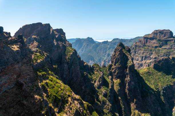
The PR1 Vereda do Areeiro route connects three iconic locations on the island of Madeira, situated at its highest altitudes. The journey begins at Pico do Areeiro, which reaches an altitude of 1818 meters, then passes through Pico das Torres, standing at 1851 meters, and finally arrives at Pico Ruivo, whose summit is at 1862 meters. The sunrise at 6:00 AM is spectacular.
Hiking Technical Sheet
- Average Duration: 3h / 3h30
![plage seixal sable noir]()
- Distance: 10.8 km
![plage seixal sable noir]()
- Elevation Gain:
![plage seixal sable noir]()
- Elevation Loss:
![plage seixal sable noir]()
- Highest Point: 1862 m
![plage seixal sable noir]()
- Lowest Point: 1542 m
![plage seixal sable noir]()
- Difficulty: Hard
![plage seixal sable noir]()
- Return to Starting Point: Yes
![plage seixal sable noir]()
- Municipality: Pico do Areeiro
![plage seixal sable noir]()

This trail, named Vereda do Areeiro, spans approximately 7 kilometers. It has a moderate difficulty level and takes around 3 and a half hours to complete. It crosses a part of the Central Massif, an area included in the Natura 2000 network. Along this trek, which starts from the Pico do Areeiro viewpoint, you'll have the opportunity to traverse old tunnels carved into volcanic formations, which were once used as shelters for livestock and shepherds, as well as steep slopes.

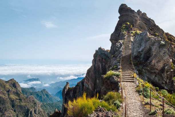
To reach Pico Ruivo, you'll need to circumvent Pico das Torres by taking a steep staircase carved into the rock. However, the ultimate challenge of Vereda do Areeiro awaits you: the ascent to the Casa de Abrigo do Pico Ruivo refuge.

Finally, you'll discover a well-known rock formation called 'Homem em pé' (the standing man), where you'll find the path leading to Achada do Teixeira, allowing you to continue your trek. During this hike, where mountain heathers prevail, you'll have the opportunity to observe some bird species and subspecies found only in Macaronesia or in this particular archipelago.


